What is laser scanning?
Laser scanning, a form of land surveying, has emerged as a fast and accurate method to capture spatial details of existing buildings and structures. By utilising advanced high-definition laser scanners, this non-invasive technology collects precise geometric data from both exterior and interior environments.
Why choose Bonisch?
While laser scanning might appear as plug-and-play technology available to anyone with a tripod, the fundamental principles of surveying remain pertinent in data capture of this kind. With over four decades of experience, we harness this extensive knowledge to ensure a successful project outcome.
Our approach starts by understanding our client's needs and assessing whether laser scanning is the optimal tool for the task. Our process involves a holistic understanding, recognising the significance of data redundancy. All point clouds are not equal and stand by our quality assurance process to ensure successful capture.
Back in our office, we meticulously extract data aligned with project requirements, delivering outputs compatible with software tools like Revit or ArchiCAD, streamlining design collaboration.
Laser scanning has revolutionised spatial data capture and design efficiency, offering numerous benefits for the construction industry. Its ability to expedite surveys, foster collaboration, identify potential issues, and integrate with software tools makes it an asset for professionals and their clients alike.
Invercargill Re-Development Block
An example of our laser scanning services includes our involvement in the Invercargill re-development block. Due to our early involvement as part of the development team we were able to offer our laser scanning services.
The challenge from Invercargill Central Limited was the need for an accurate exterior survey of all block buildings prior to preservations/demolition. They also sought a historical reference of the heritage structures, be it for preservation or for historical context. Recognising that laser scanning was the ideal tool for the task, our team of experts committed to delivering the required level of service.
We highlighted that laser scanning was the right tool for the job, and that the Bonisch team of experts could provide the level of service they needed.
The project involved comprehensive data capture of the city block, meticulously referencing both vertical and horizontal datums. Our laser scanner provided a swift and efficient solution for the extensive data captured.
The result was a detailed scanning survey and associated dataset to a known accuracy. This data now lives as a historical record at a point in time for Invercargill City and can be referred to for a variety of needs for now and in the future.
Bupa Care Facility, Christchurch
Another project reference that utilised our laser scanning services is the Bupa Care facility in Ilam. Due to our long-standing relationship with Bupa, the Bonisch team have had project involvement within previous stages of this project.
Bupa wanted an accurate exterior survey of the exterior of an existing apartment block to assist with the interface of a proposed building extension. Along with this, Bupa was looking to de-risk the design extension by scanning the exterior of the existing building an integrating this into the project Building Information Model (BIM).
The project included the full data capture of the existing building, with reference to the historical grid line setout and finished floor level datums. The result was a comprehensive scanning survey with extracted data tailored to the client’s requirements, all of which were seamlessly integrated into the project’s BIM. This offers a digital replica of the building, ensuring precise design of the extension.
For more information on these services, contact admin@bonisch.nz
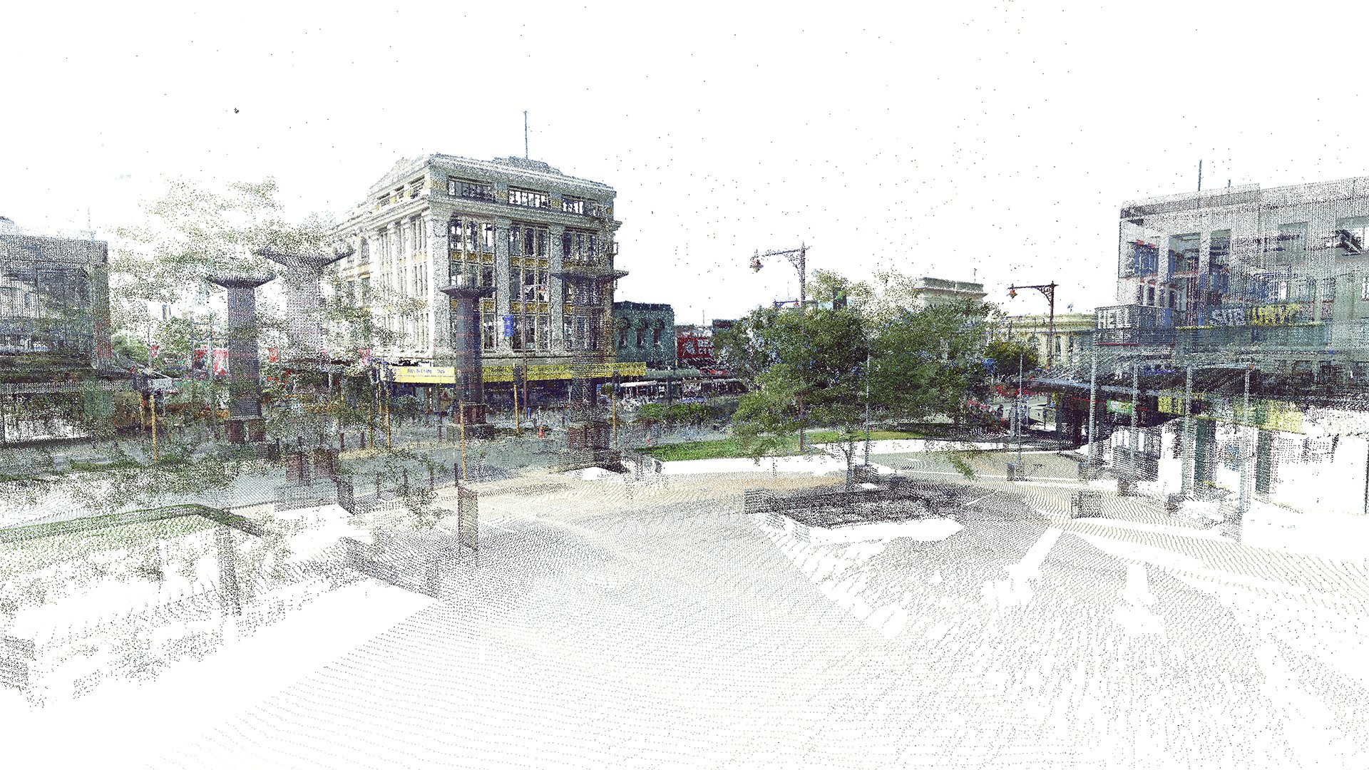 Image 1 of 7
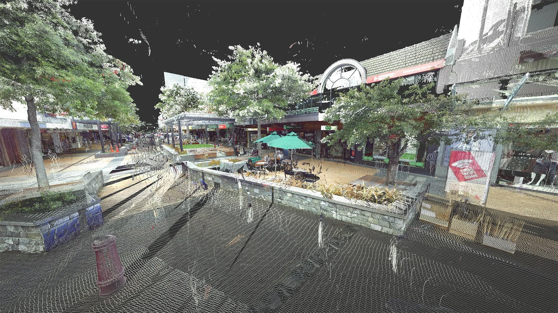 Image 2 of 7
 Image 3 of 7
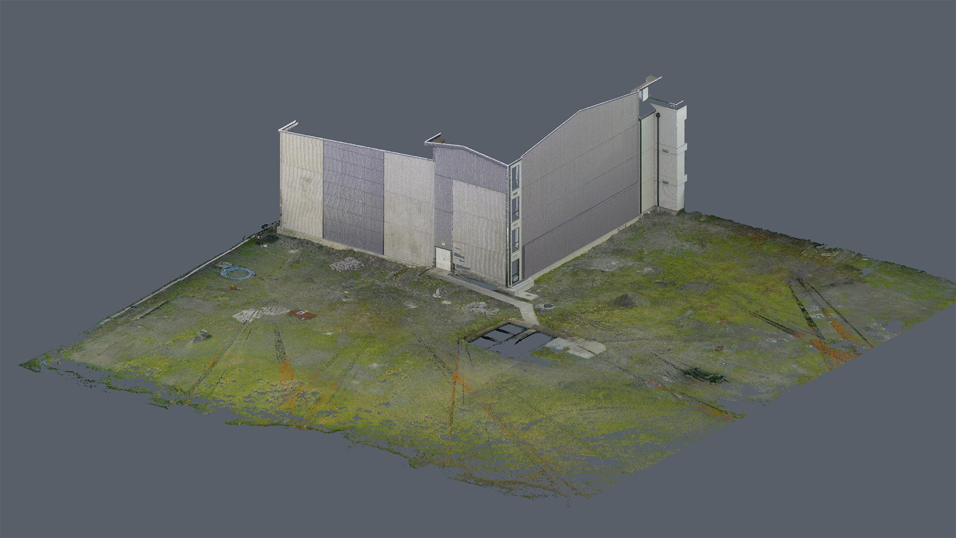 Image 4 of 7
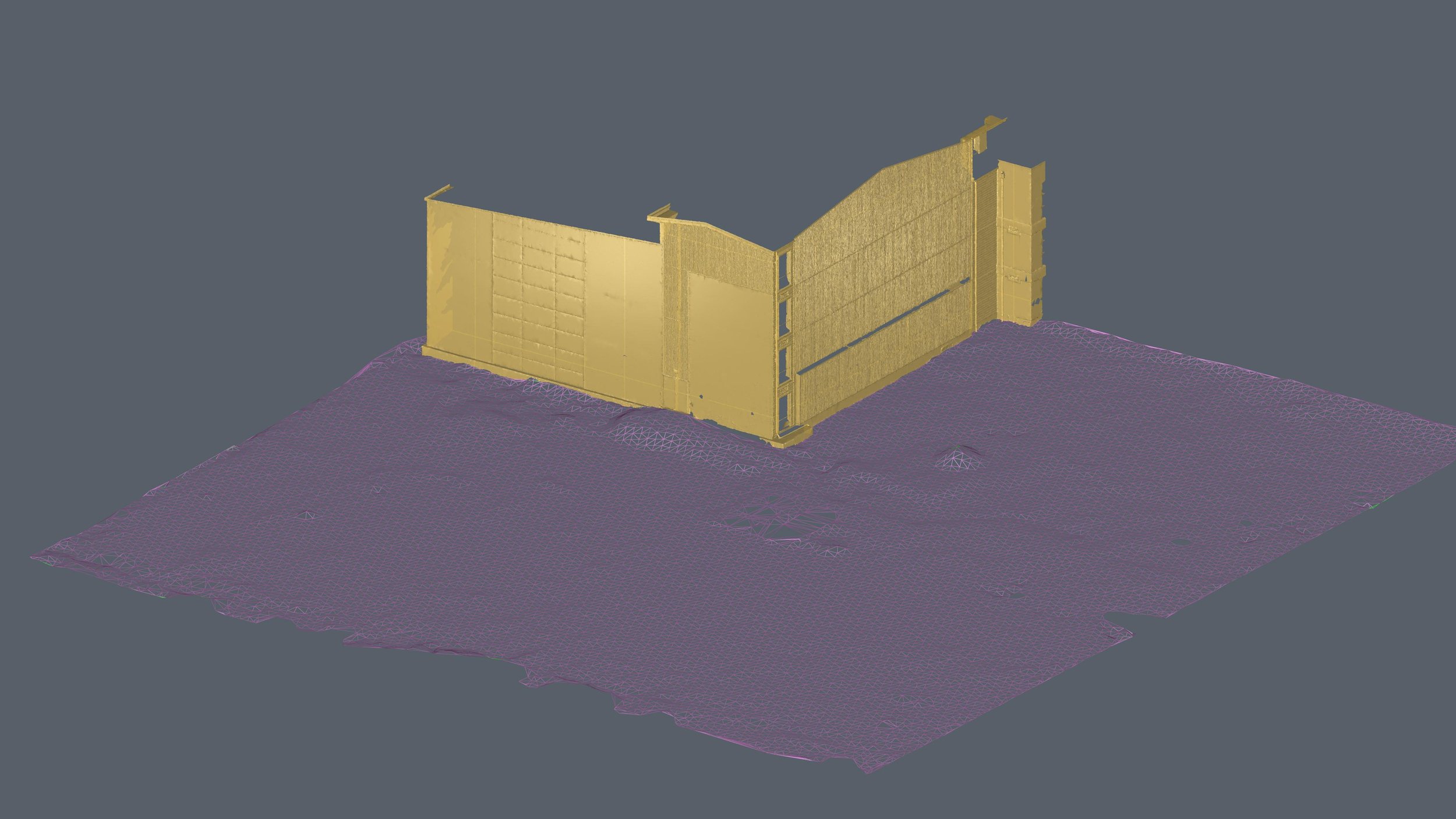 Image 5 of 7
 Image 6 of 7
 Image 7 of 7